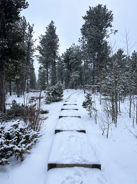
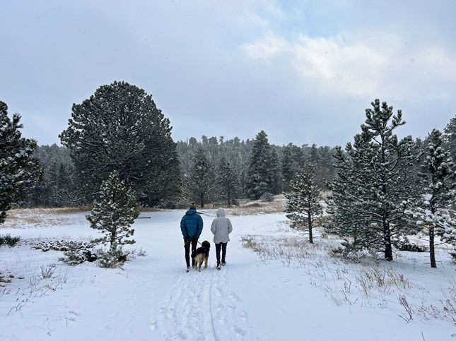
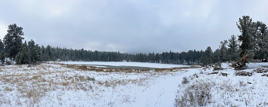
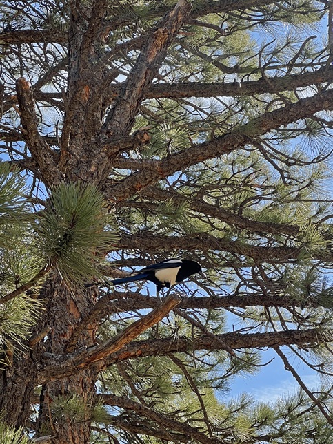
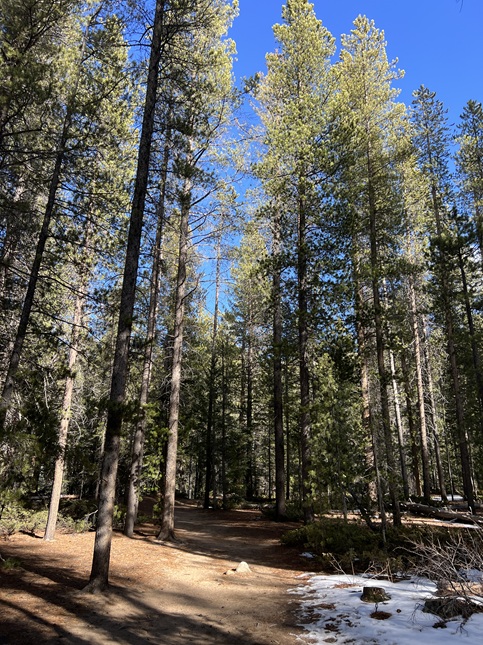
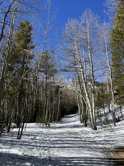
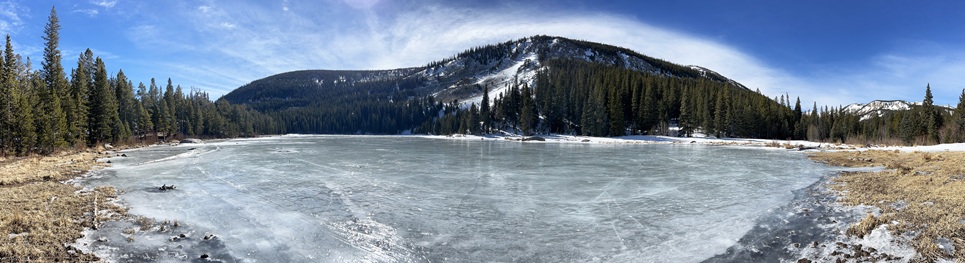
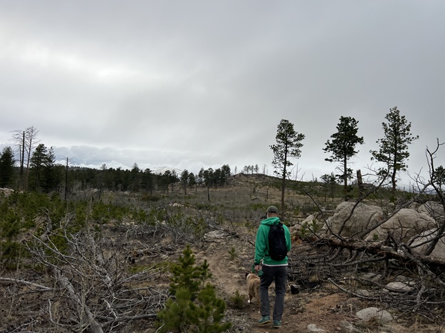
1) Mud Lake, Boulder County Parks & Open Space, Nederland, CO, January 8, 2026 - For our first hike of the new year we met up with our friend Holly and her pup Mikyo. We met up at the back entrance to the Mud Lake Open Space, on County Road 128W, and did both the Kinnickinnick Loop and Tungsteen Loop. We were in the midst of a snow storm with about 4 inches of fresh powder on the ground and more falling while we were hiking which gave us a cold but beautiful snow covered forest to enjoy. The weather also kept other hikers off the trail so we only saw a couple of other people. A nice way to start off our 2026 hikes! A 2.3 mile loop with 250 feet of elevation gain.

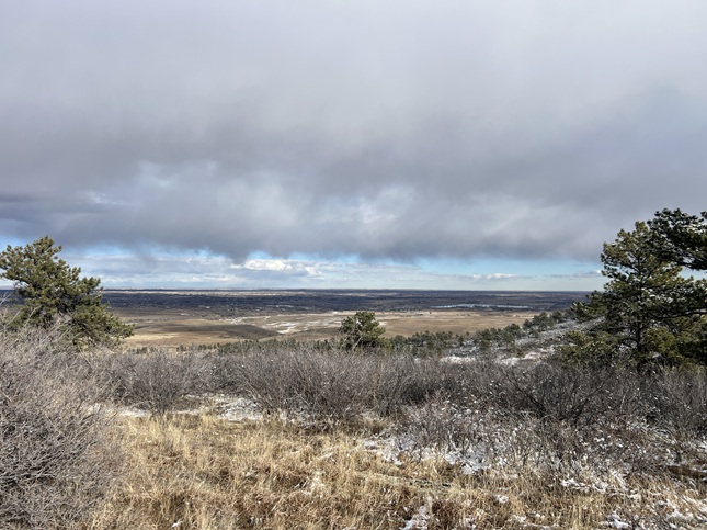
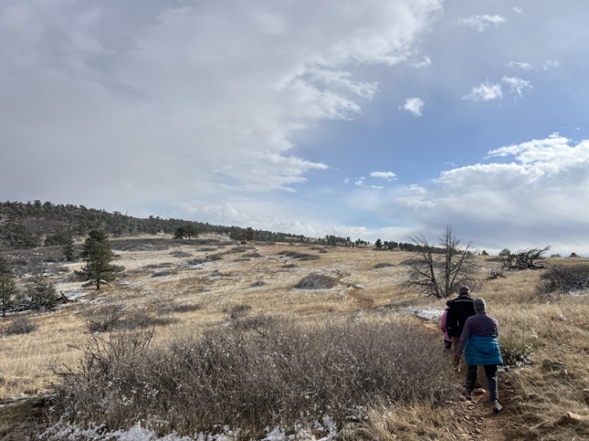
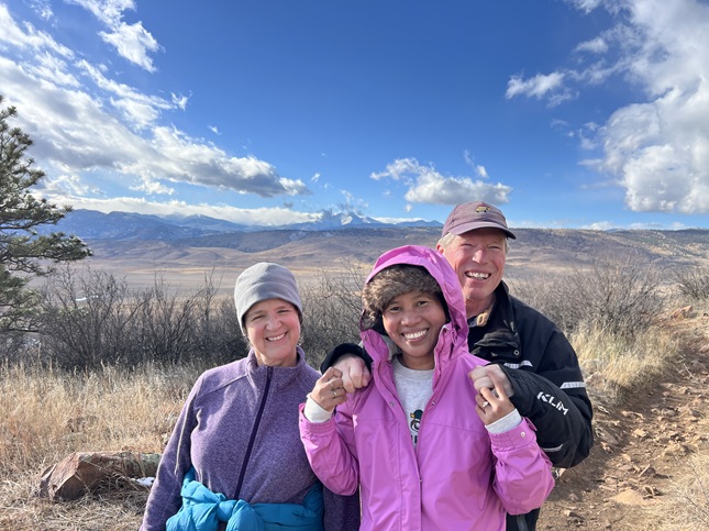
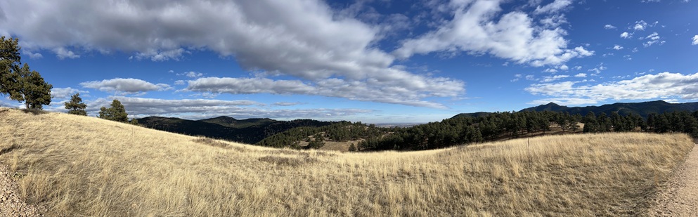
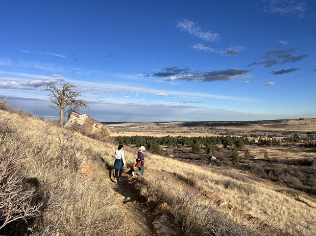
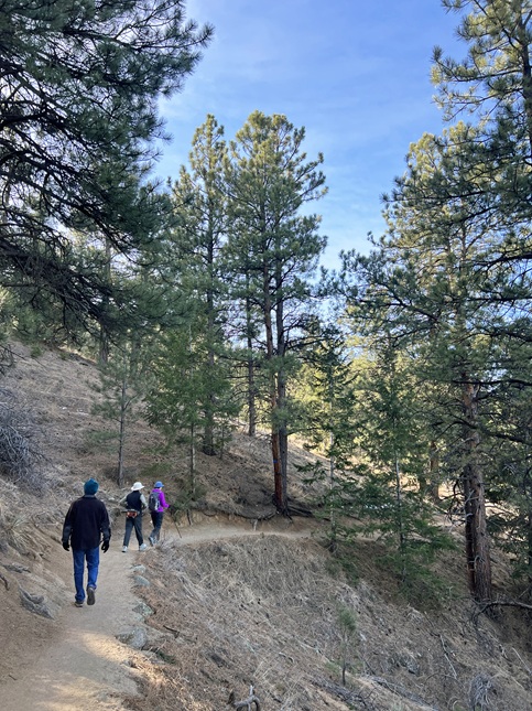
2) Eagle Wind Trail, Ron Stewart Preserve at Rabbit Mountain, Boulder County Parks & Open Space, Lyons, CO, January 9, 2026 - We traded the fresh snow in the mountains for the dry hills down below for our second hike of the year. For this one we met up with Todd and Janeth at Rabbit Mountain Open Space to hike the Eagle Wind Loop trail. There were a few patches of snow but the ground was mostly dry. The temperature was hovering just below of freezing but thankfully there wasn't much wind and there was a little sun so the weather wasn't too bad for hiking. The views onto the Front Range was fantastic with the snow-covered mountains peeking in and out of some low lying clouds. We watched a hawk hunting in the grasslands and saw a few other hikers but mainly enjoyed a quiet trail. A 4 mile loop with 350 feet of elevation gain.
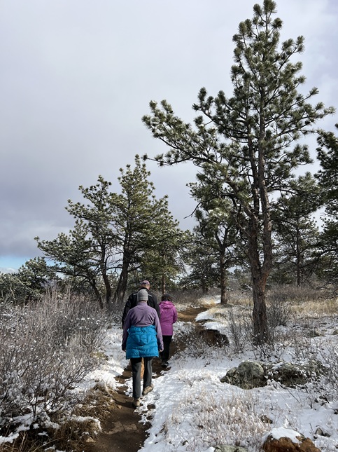
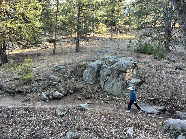
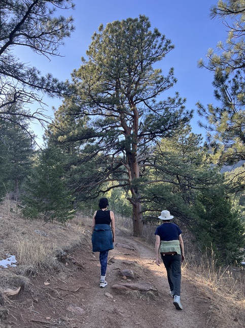
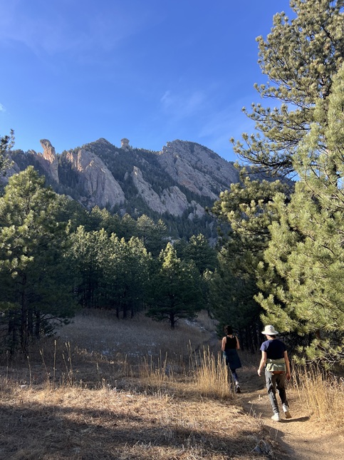
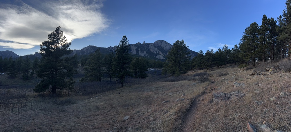
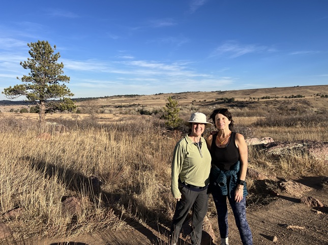
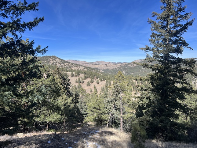
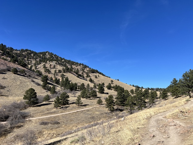
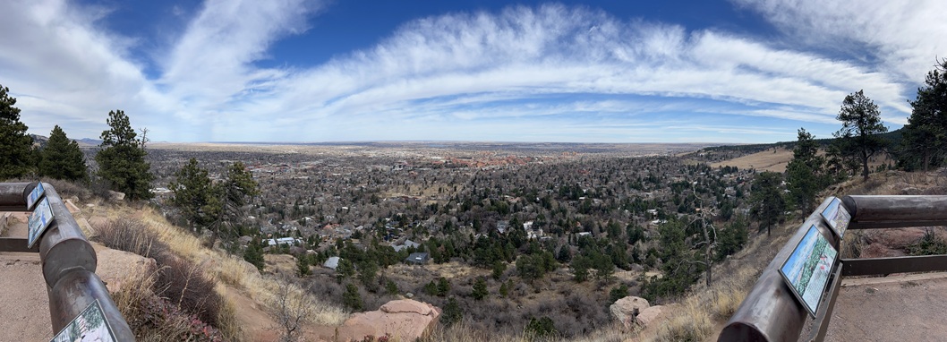
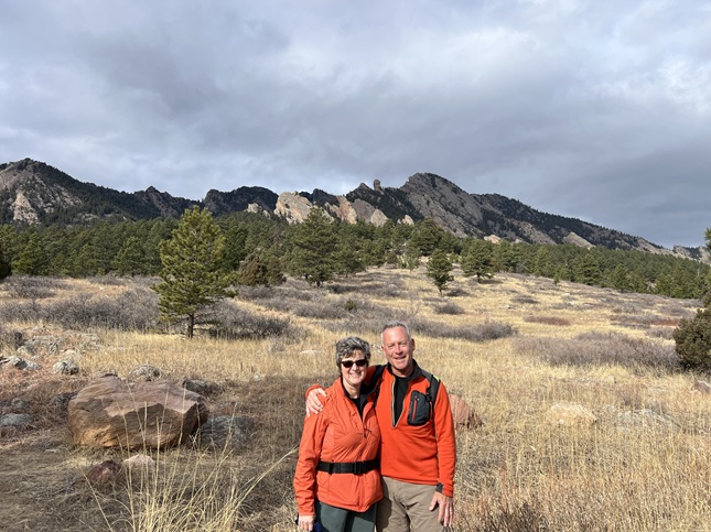
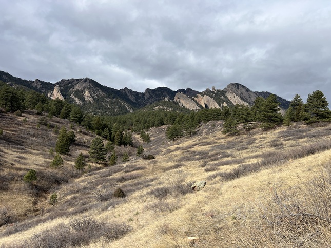
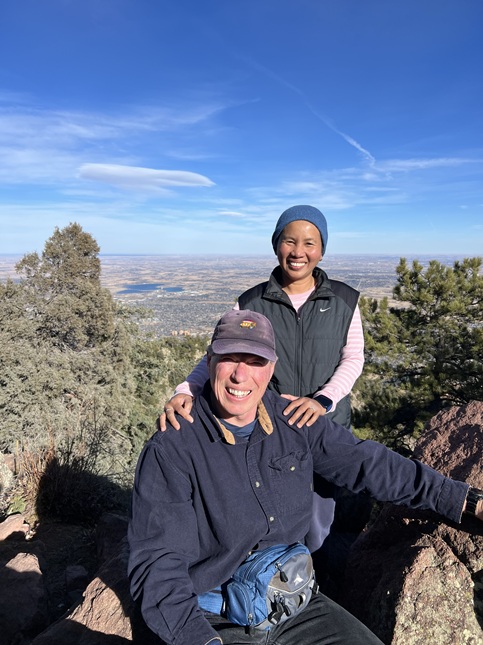
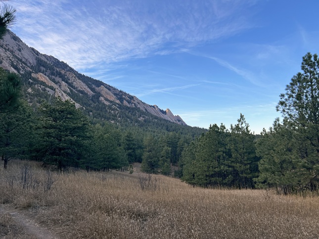
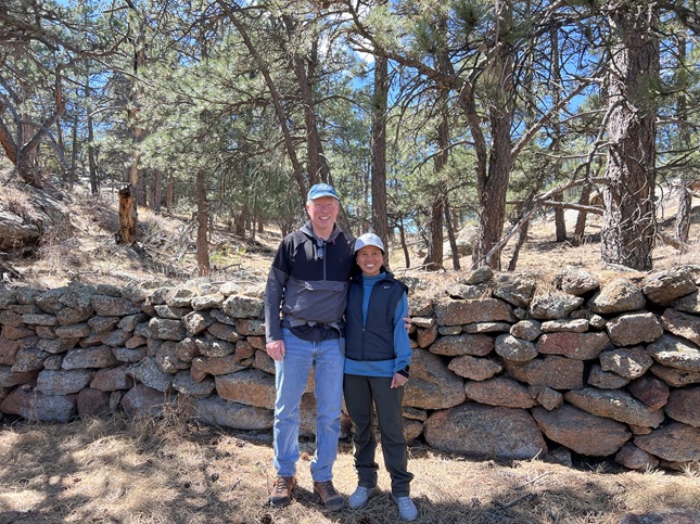
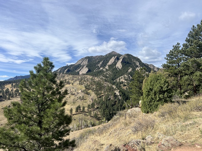
3) Canyon Loop, Betasso Preserve, Boulder County Open Space, Boulder, CO, January 15, 2026 - After running errands down in Boulder, Jonna and Alan stopped by Betasso Preserve on the way back up the canyon to hike the main Canyon Loop. It was a beautiful day - warm and sunny - which is usually a good thing but given how little snow we've had this winter and how dry the ground is turned out to be a sad thing. Nonetheless, we had nice views from the high points on the trail looking down onto Boulder and got to see a family of deer nibbling the dry grasses. A nice place for a quick leg stretcher and on Wednesday there it is pedestrian and equestrian only so we didn't have to dodge mountain bikes. A 3.4 mile loop with 400 feet of elevation gain.
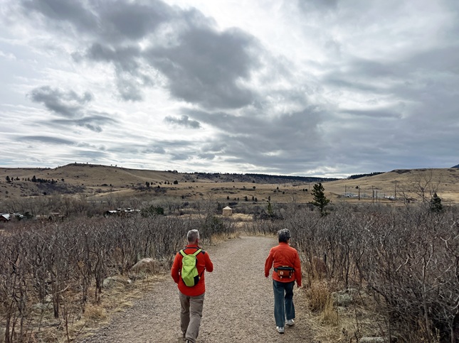
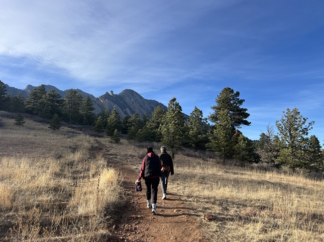
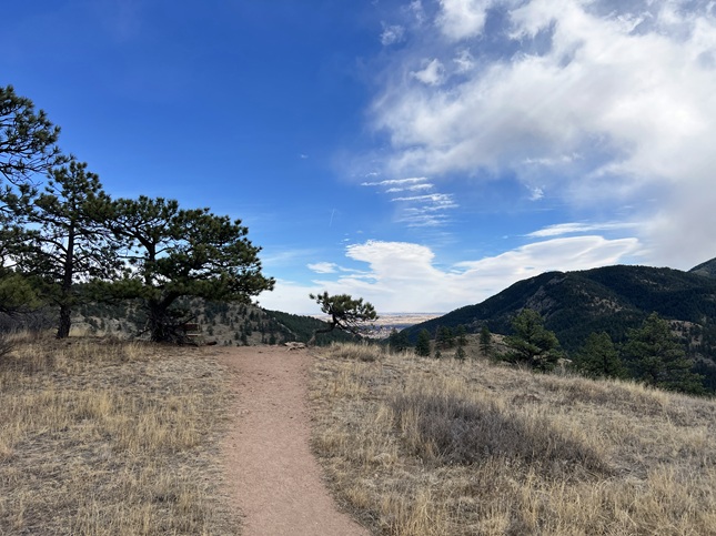
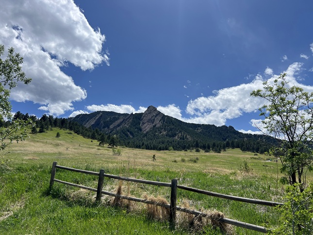
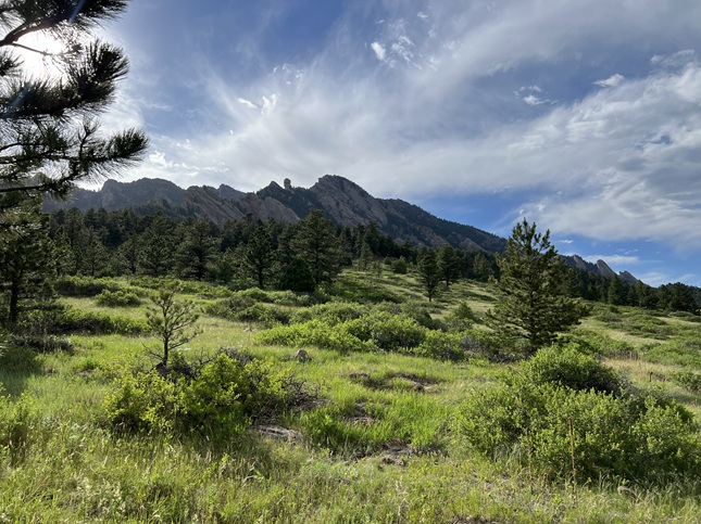
4) Homestead, Mesa, Upper Big Bluestem and Big Bluestem West Trails, South Mesa Trailhead, Boulder Open Space & Mountain Parks, Boulder, CO, January 18, 2026 - Our first hike of the year with our friend Desiree was on a beautiful Sunday afternoon with wind-swept clouds floating through a deep blue sky. The trails were, unfortunately, completely dry and hillsides were covered with tinder dry grass. We started at our traditional spot, the South Mesa Trailhead, and did a big loops going out on Homestead and Mesa trails before circling back on Upper Big Bluestem and Big Bluestem trails. The highlight of the hike was seeing an Abert's Squirrel with its big tasseled ears and long fluffy tail. We timed it perfectly so that we ended the hike exactly as the sun set behind the foothills. A 4.8 mile loop with 800 feet of elevation gain.
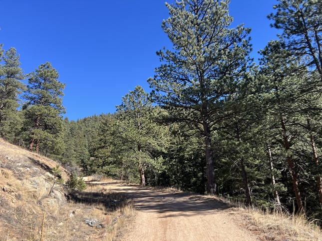
5) Lookout, Hobbit 4, Hobbit 3 and Observatory Trails, West Magnolia trail system, Nederland, CO, January 30, 2026 - Jonna and Alan took a break from tasks around the house for a quick Friday afternoon. We headed to the nearby West Magnolia trail system where we started from the Lookout Trail trailhead. After hiking up to the lookout we discovered a new trail, named Hobbit 4, had been built that circled around the YMCA camp and then connected to the old Hobbit 3 trail just south of the West Mag campground. Made a loop by connecting the Lookout, Hobbit 4, Hobbit 3 and Observatory trails. Despite a few small snow falls the warm, sunny weather has melted out most of the snow so at most we only had to deal with ankle deep snow in the forests but hiked on dry trail in the more open areas. We did pick up some trash along the way so the lack of snow at least allowed us to do a little clean-up in the campground area. A 3 mile loop with 400 feet of elevation gain.
6) Homestead, Mesa, Upper Big Bluestem and Big Bluestem West Trails, South Mesa Trailhead, Boulder Open Space & Mountain Parks, Boulder, CO, February 1, 2026 - Once again, the unseasonably warm weather gave us a beautiful hike but the lack of snow continues to cause us a lot of concern since a drought now will likely mean high fire risk this summer. Nonetheless, we got together with our friend Desiree at our usual trailhead - the South Mesa Trailhead - for another Sunday afternoon hike. We have been doing a new loop the past couple of times we've hiked with Desiree and did that again today. We start up the Homestead Trail, which we've been doing for many years, but now when we reach the Mesa Trail we continue north to where it meets the Upper Big Bluestem Trail. We then take that in a big loop to the east to where the Big Bluestem West Trail branches off to re-connect with Mesa Trail. This gives us a nice loop with some scenic views of the front range mountains with the evening sun setting behind them. A 4.8 mile loop with 800 feet of elevation gain.
7) Canyon Loop, Betasso Preserve, Boulder County Open Space, Boulder, CO, February 4, 2026 - We get together regularly with our friends Steve and Kristin - often for lunch or to go for a walk around Boulder. However, every now and then, we go on a hike together and we took advantage of the mid-week "No Mountain Bikes" day at Betasso Preserve to hike there. We met up at the eastern overflow parking lot and then did a counter-clock hike around Canyon Loop. The weather was great for hiking (but terrible for our normal winter snow) and the trail was very lightly populated. We didn't see anything in the way of wildlife or unusual scenery or memorable moments but we all still felt lucky to live in such a beautiful place and to have the ability to get out to enjoy it. A 3.4 mile loop with 400 feet of elevation gain.
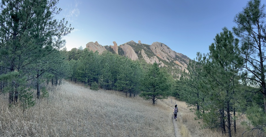
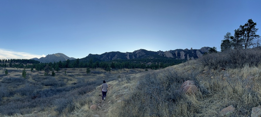
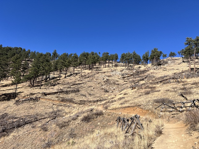
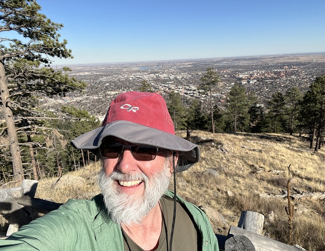
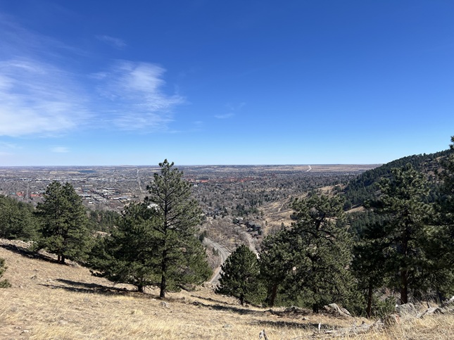
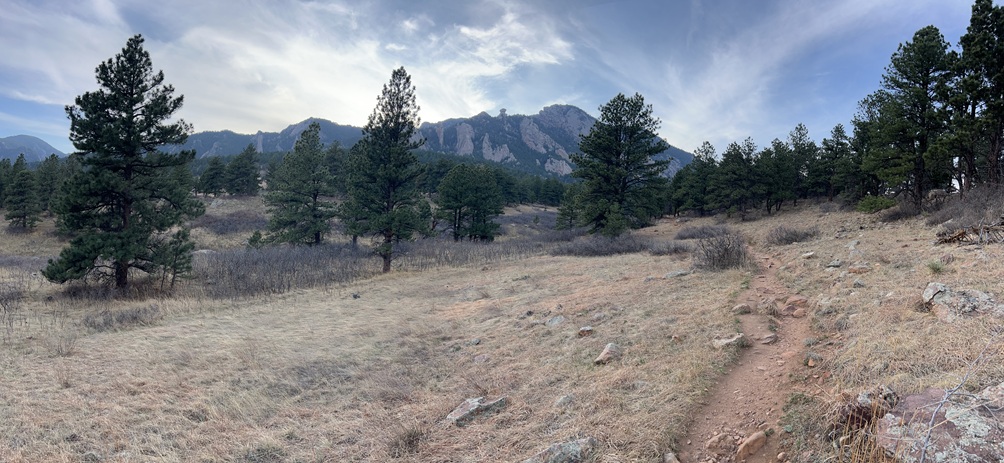
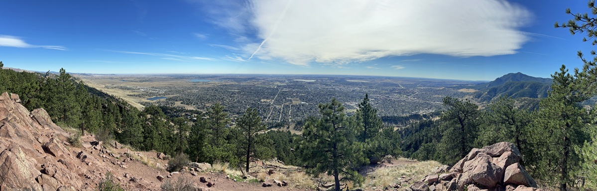
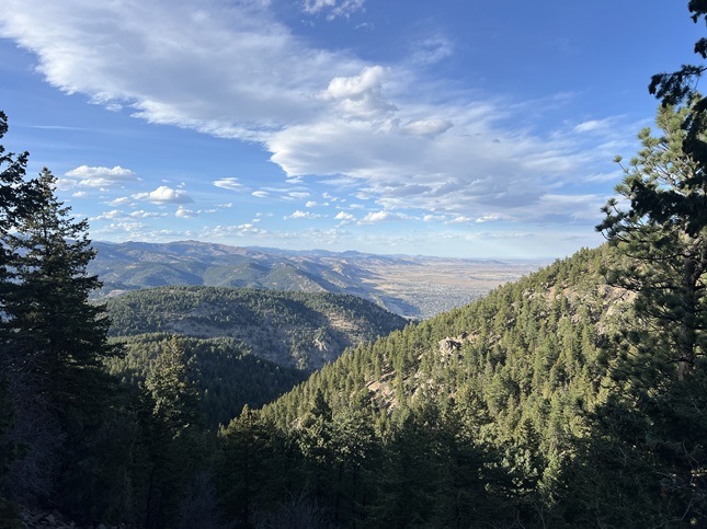
8) Mt. Sanitas, Boulder City Open Space & Mountain Parks, Boulder, CO, February 5, 2026 - Normally, I start my annual Spring training hikes at the end of February and in early March. But with us having full summer weather right now I decided to get an early start. On February 5th we had 75 degree weather down in Boulder - when historically February is our snowiest and second coldest month. But this year the trails are dry and dusty, and everyone is out hiking in shorts and t-shirts. So despite my deep concerns for what this weather will mean for the summer I headed down to the People's Crossing Trailhead to do the first of my five training hikes. Boulder Open Space has re-routed the Red Rocks Trail so I had to take a slightly different route than in the past to go up and over Red Rocks Park. Then it was the usual Dakota Ridge Trail to go north along the front of Mt. Sanitas. At the end of Dakota Ridge the trail turns into the East Ridge trail and it took that all the way up the east face of the mountain. There is one section near the top that is always icy when I do this hike but it was completely dry this year. Good for hiking but terrible for our moisture levels. Up at the top, I got to watch a group of five paragliders fly past, one down low enough over Dakota Valley that I was looking down onto the top of his paracute! The highlight for me was watching a pair of crows who were playing in a thermal right over the top of the mountain - circling, gliding and squawking in playful flight. Shortly thereafter, the paragliders found the same thermal and climbed a few hundred feet up above Sanitas. I used the South Ridge trail to drop back down to the bottom of the mountain. It was slow going and my knees were telling me how out of shape I am the whole way down. That is why I do these training hikes but clearly I need to do a little extra this winter to get more strength into my legs! I used the Anemone Trail to go part of the way around Red Rocks and then climbed back over on the Red Rocks trail to return to the trailhead. My first training hike of the year is done and I've got an idea of where I stand so I'll increase my hiking this month to try to get back up to where I expect to be. A 4.5 mile loop with 1,500 feet of elevation gain.
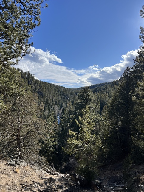
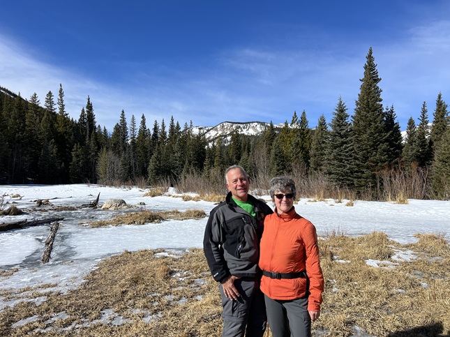
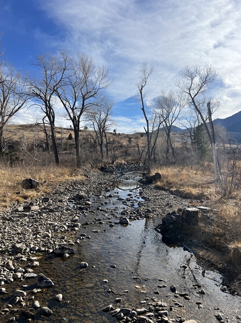
9) Ceran St. Vrain Trail, Boulder City Open Space & Mountain Parks, Boulder, CO, February 7, 2026 - On a warm winter Saturday afternoon we got a call from our friend Holly asking if we wanted to go for a hike so we threw on hiking clothes and headed north to the Ceran St. Vrain trailhead to meet up with Holly, her partner Rick and their pup Mikyo. Like so many of our trails all the warm weather has mostly melted out the Ceran St. Vrain trail even though it is deep down in a creek valley. There were a few stream crossings that were iced over and a few spots where residual packed snow was still on the trail but mud was as big a problem as snow. The other thing that was obvious since the last time we've hiked this trail is that the recent windstorms have brought down a lot of trees. In some of the forested areas there were dozens of trees blown down along with many stumps and bare trunks. All that dry wood on the ground was just another reason to have us doing a snow dance... A 4.2 mile out-and-back hike with a mellow 400 feet of elevation gain.
10) Flagstaff Mountain, Boulder City Open Space & Mountain Parks, Boulder, CO, February 8, 2026 - Jonna's brother Jamie came out to visit us in Colorado so shortly after we picked him up from the airport we were strapping on hiking boots and taking him out for a hike - specifically the second of my annual Spring Training Hikes. Our friend Desiree joined us at Eben G. Fine park in Boulder. We started by climbing up the Viewpoint Trail to Panorama Point then changing over to the Flagstaff trail for the ascent all the way to the summit. Along the way, first Desiree and then Jonna turned back leaving just Jamie and Alan to complete the climb. Once on the top, we took the Rangeview trail to the west side of the mountain so we could enjoy the views of the Continental Divide, then took the Ute trail back to the summit to complete a loop on top. Then we backtracked down Flagstaff and Viewpoint trails to the trailhead. The weather was again unseasonably warm and the trail was dry dirt for almost the entire hike...good for hiking but still frightening for our snow levels. On the plus side, this trail is usually a muddy mess but this year it was so dry it was dusty! A 6.6 mile up-and-back hike with 1,800 feet of elevation gain.

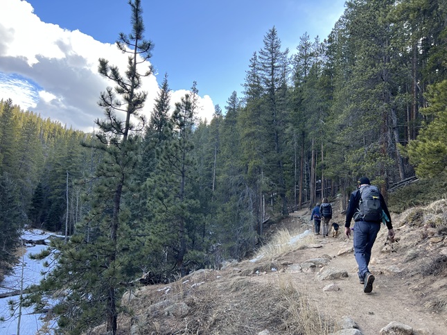
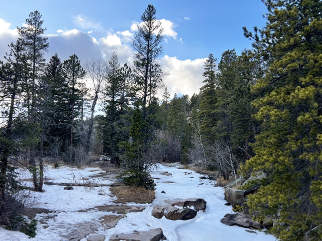
11) Lost Lake, Hessie Trailhead, Boulder County Open Space, Eldora, CO, February 9, 2026 - With Jamie visiting we are maximizing our hiking so after doing Flagstaff Mountain the previous day we were up early and back out hiking again the very next morning. This time Jamie, Jonna and Alan drove up to the Hessie Trailhead outside Eldora and did the hike in to Lost Lake. Another sign of just how bad our snow situation is rigth now is the fact that we could even drive to the trailhead. Normally, the Fourth of July road out of Eldora is closed in the winter but right now it is free of snow and ice so we could drive all the way in to the trailhead. It was clear but windy so we bundled up in layers and headed down the trail. Just past the old Hessie townsite the trail started to be covered with packed snow and ice so we put on microspikes and wore those for the rest of the hike. We had some nice views onto the surrounding mountains and this high up (~9,600 feet) there was actually some snow. Lost Lake was frozen over so at least if felt a bit like winter once we were up there. We made good time and were back at the trailhead in time to pick up lunch in Nederland on the drive back home. A 4.2 mile up-and-back hike with 850 feet of elevation gain.
12) Homestead, Mesa and Towhee Trails, South Mesa Trailhead, Boulder Open Space & Mountain Parks, Boulder, CO, February 10, 2026 - For the third day of Jamie's visit we headed out for yet another hike but we were starting to feel the effect of back-to-back hikes so we made this one a shorter one. We've told Jamie about our regular hikes with our friend Desiree so we brought him to hike our "short" loop from the South Mesa Trailhead. There was a big bank of clouds over the front range with rain in the forecast for noon but the morning sun was coming in at a low enough angle to shine on the trails. We started on the Mesa Trail, then turned onto the Homestead Trail for the climb up the hillside, then we turned back on Mesa for a short distance before turning onto the Towhee Trail for the return to the trailhead. As we got back to the car dark clouds blocked out the sun and the temperature dropped to below freezing so we felt we'd timed it perfectly. A 3 mile loop with 500 feet of elevation gain.
13) Chapman Drive & Tenderfoot Trail, City of Boulder Open Space and Mountain Parks, Boulder, CO, February 14, 2026 - After a couple of days relaxing to recover from all the hiking we did during Jamie's visit we were feeling a bit slothful. On a Saturday afternoon we decided to get out for another hike and since our last few hikes involved some elevation we opted to continue that by hiking Chapman Drive near the mouth of Boulder Canyon. The trailhead was recently rebuilt making it a much more formal hiking spot than it had been previously. This means a lot more traffic, particularly bicyclists who make a loop by cycling the Boulder creek bike path to the trailhead, then biking up Chapman Drive to the top of Flagstaff Mountain and then coasting down Flagstaff Drive back into Boulder. We did the climb from the trailhead all the way to the top but then came back down via Tenderfoot Trail which allowed us to avoid the bicycle traffic for half the return trip. A cloudless sky showed off the mountains of the Continental Divide which had been covered with snow by an overnight storm. Beautiful! A 5.2 mile loop with 950 feet of elevation gain.
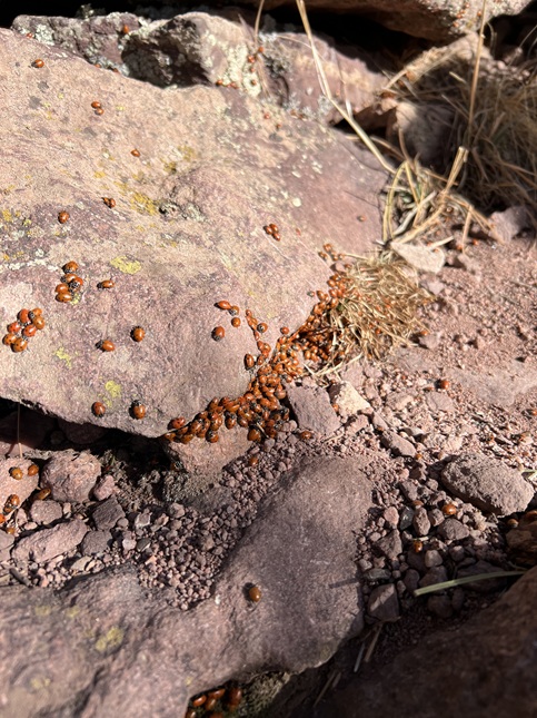
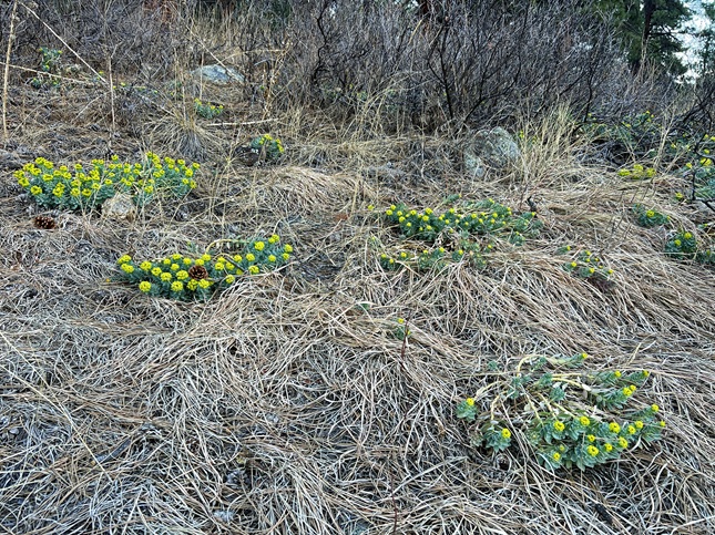
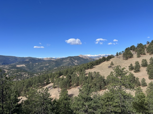
14) Green Mountain, Boulder County Open Space & Mountain Parks, Boulder, CO, February 15, 2026 - My stated goal a little over a week ago was to get in more hiking so build up the strength in my legs and I've definitely done that. My friend Todd and his wife Janeth joined me for a hike today. After hiking to the top of Flagstaff Mountain yesterday today we started at teh top of Flagstaff and climbed to the top of Green Mountain. The day was fantastic for hiking - temperatures in the mid-60s, sunny and only a few clouds in the sky. There were two signs that show just how unusual this winter has been. The first was when we reached the summit (via the Ranger and EM Greenman trails) and found swarms of mating lady bugs. I've seen this behavior on top of mountains in late March or early April - this year it is happening in mid-February. The second unusual thing was seeing hillsides covered in green grass. ...and not just fresh buds emerging from the ground but healthy, 6 inch long blades like what I'd expect to see in April. Wow. The views from the top were great and the trails almost entirely free of snow or ice. Just a few sections on the north side of the mountain where compressed snow/ice was on the trail. We descended via the West Ridge and Ranger trails to complete the hike. A 4 mile loop with 1,500 feet of elevation gain.

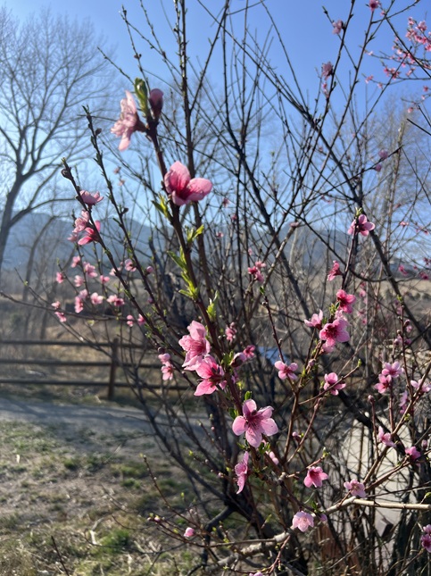
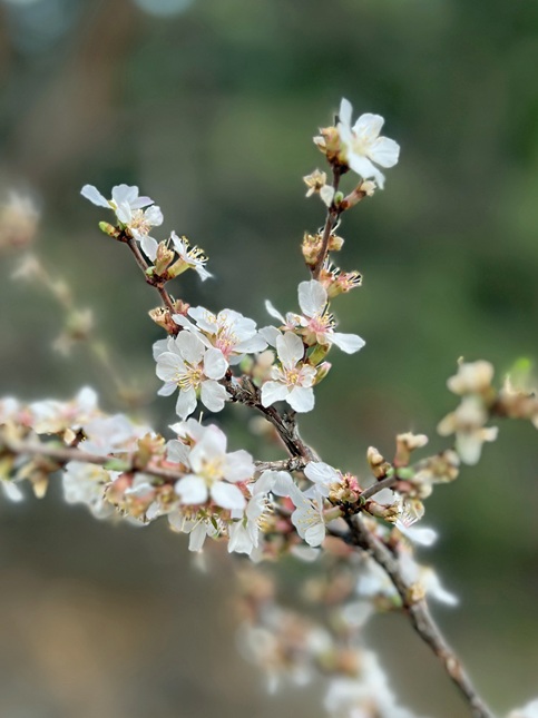
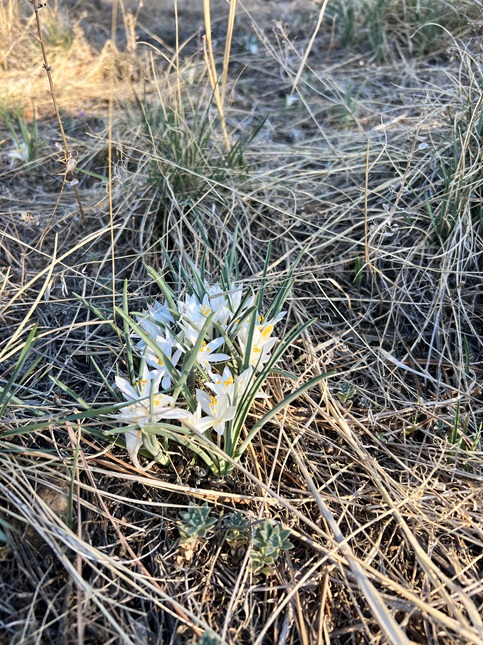
15) Homestead, Mesa, Upper Big Bluestem and Big Bluestem West Trails, South Mesa Trailhead, Boulder Open Space & Mountain Parks, Boulder, CO, Feburary 22, 2026 - On the Eve of Jonna's birthday we joined our friend Desiree for our regularly scheduled Sunday evening hike. As usual, we met at the South Mesa Trailhead and we did what is becoming our new normal for a hike. Going up Homestead Trail to where it joines Mesa Trail then taking the Mesa trail north to the junction with Upper Big Bluestem Trail. We then took that trail east to where it meets the Big Bluestem West Trail which goes south to re-connect with Mesa trail. We got back to the trailhead after the sun had set behind the mountains and the temperature started to drop which meant we were chilled when we got back to the cars. A 4.8 mile loop with 800 feet of elevation gain.
16) Canyon Loop, Betasso Preserve, Boulder County Open Space, Boulder, CO, January 15, 2026 - After running errands down in Boulder, Jonna and Alan decided to once again stop off at Betasso Preserve to fit in a quick afternoon hike before driving back up the mountain to home. The morning had been a mix of sleet and wind and then sunshine so we were happy to find we timed our hike perfectly to have a little sun and a little overcast sky but no rain or sleet or wind. The hike is a simple one hiking the Canyon loop and the only thing worth noting was spotting a couple of deer but it is a great trail for getting some exercise and one a Wednesday afternoon it is basically deserted so overall a good hike! A 3.4 mile loop with 400 feet of elevation gain.
17) Homestead, Mesa, Upper Big Bluestem and Big Bluestem West Trails, South Mesa Trailhead, Boulder Open Space & Mountain Parks, Boulder, CO, March 2, 2026 - Busy schedules this weekend meant we pushed our regularly scheduled hike with our friend Desiree to Monday afternoon rather than our usual Sunday hike. We did our usual Homestead-Big Bluestem-Mesa loop from the South Mesa Trailhead with the sun setting behind the Front Range mountains as we hiked. We spotted a deer but the best animal sighting was spotting small trout that were jumping up out of Boulder Creek to nab bugs hovering just above the water. The most shocking sight was seeing a hillside of succulents that were in full bloom. Just another sign of how freakishly warm this winter has been. A 4.8 mile loop with 800 feet of elevation gain.
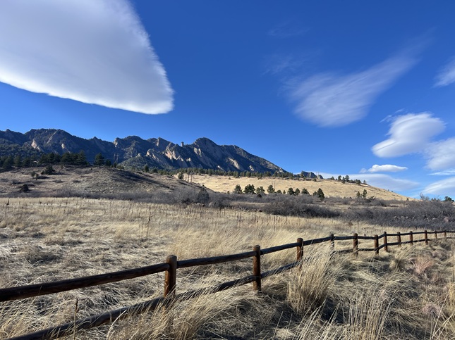
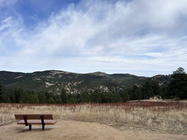
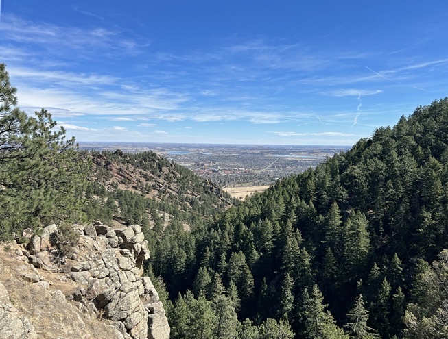
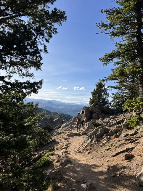
18) Anemone Loop, Centennial Trailhead, City Of Boulder Open Space & Mountain Parks, Boulder, CO, March 4, 2026 - After running errands in Boulder mid-day and mid-week I decided to stop off on my way home for a solo hike. I parked at the Centennial Trailhead with the plan of hiking Mt. Santinas to the north but after looking at the map kiosk in the parking lot I decided instead to hike the Anemone Loop to the west. About a decade ago there was a spur trail, the Anemone Trail, that climbed up a ridge to Realization Point. However, since then the City of Boulder has added a 3 mile loop winding around a hilltop even further to the west and I've never hiked this "new" trail. This turned out to be a really nice hike with views looking down onto Boulder Canyon, glimpses of the Continental Divide to the west and a couple of overlooks offering vistas looking out over Boulder. I started the hike at 2pm and seemed I had the trail mostly to myself but the later in the afternoon it got the more people I saw so I think trail runners head for this trail after getting off work in the mid-afternoon. Next time I'll try hiking this trail earlier in the day but even with the increased afternoon traffic I still enjoyed the hike. A 4.1 mile loop with 800 feet of elevation gain.


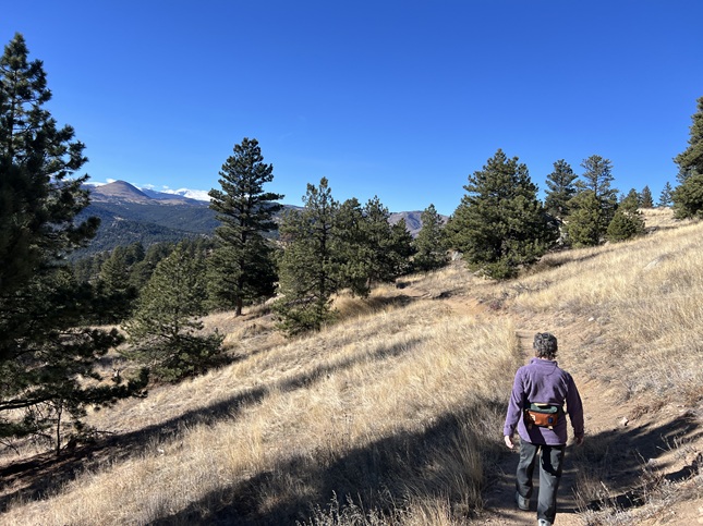
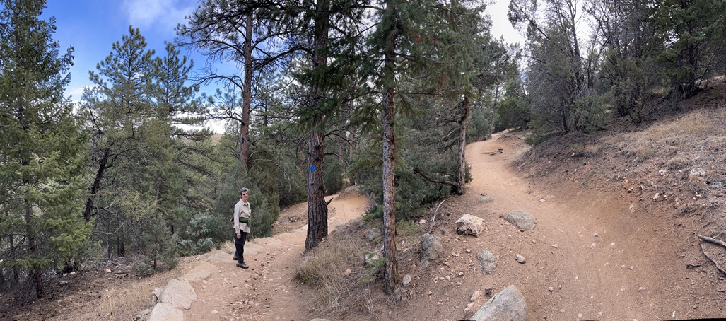
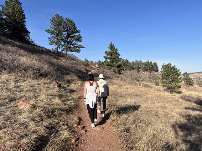
19) Anemone Loop, People's Crossing Trailhead, City Of Boulder Open Space & Mountain Parks, Boulder, CO, March 9, 2026 - The day after a snow storm moved through the area the temperatures were up in the mid-70s down in Boulder and all the snow literally evaporated. As a result, the ground was bare and dry when we got together with our friends Todd and Janeth for a hike. I'd enjoyed hiking the Anemone Loop trail enough that I wanted to share it with our friends. However, we met up at the People's Crossing trailhead rather than the Centennial Trailhead where I'd parked last week. This was a good choice because the Centennial parking lot seems to always be full but the People's Crossing parking lot usually has empty spaces. From the parking lot we hiked up the Anemone Trail which climbs up the hill towards Realization Point. There is meets the Anemome Loop trail which is a 2 mile loop along a ridgeline going west above the Elephant Butte's climbing area. We had summer-like temperatures but as the afternoon progressed the wind started to pick up so it was pretty gusty by the time we dropped back down the Anemone trail. At the end we took switched over to the Red Rocks trail to return to the parking lot - a shorter but steeper trail to the same endpoint. A 4.4 mile loop with 900 feet of elevation gain.

20) Homestead and Mesa Trails, South Mesa Trailhead, Boulder Open Space & Mountain Parks, Boulder, CO, March 15, 2026 - After such a dry winter we are happy for any moisture we can get along the front range. We had a small snow storm roll through dropping about half an inch of the white stuff down in Boulder and it came with below freezing temperatures so it didn't just melt out as if fell. To enjoy having a little snow on the ground we got together with our friend Desiree to hike our "short loop" from the South Mesa Trailhead. We hiked up Homestead Trail as usual and found it a muddy mess. Once we were back on the gravel of the Mesa trail the wind started to pick up a little and a few flakes fell from the sky so we decided to turn back. We skipped returning via the Towhee Trail since it would likely have also been sticky mud so we stuck with the more maintained Mesa trail all the way back to the trailhead. Not a particularly long hike but at least we got to feel a little bit of winter. A 3.2 mile loop with 600 feet of elevation gain.

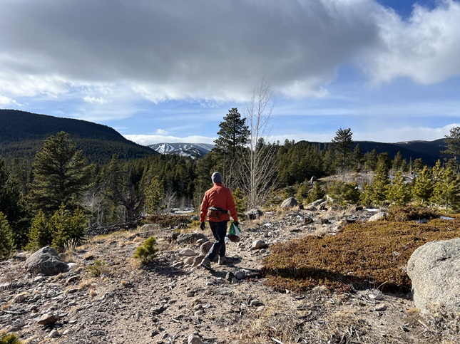
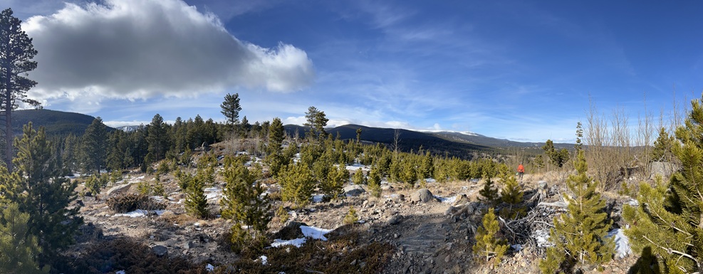
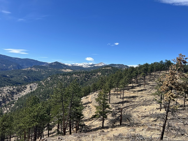
21) Green Mountain, Boulder County Open Space & Mountain Parks, Boulder, CO, March 17, 2026 - It is St. Patrick's Day and that means it is time for Alan's annual "Hikin' O' The Green" as well as the third of his five Spring training hikes. Because of the excessively dry winter this was actually the second time this year Alan hiked Green Mountain but this one followed the traditional training hike route: Starting at the Gregory Canyon parking lot and then climbing up via Amphitheater, Old Saddle Rock, New Saddle Rock and E.M. Greeman trails. Despite having a dusting of snow a day ago the trails were mostly dry, with just a little packed snow and ice near the very top. The weather was warm with only a few wispy clouds so great hiking weather but as I've felt for the past two months I'd consider the weather better if it was 18 degrees and snowing... All the hiking I've been doing in February must have paid off because I managed to maintain a slow but steady pace for the climb to the top. Only saw four people on the way up and maybe another dozen on the way down to a quiet day on the mountain. The drop down on the West Ridge, Ranger and Gregory Canyon trails wasn't nearly as slippery as past years which meant my knees didn't take the beating I've become accustomed to on the decent. Oh, and the grass I found growing so early when I did this hike back in February was even more lush today - it was odd to see a month ago and still was today. A great day of hiking and I felt good about what shape I'm in at this point in my spring training so I am happy as I mark Green Mountain off from my spring hiking schedule. A 5.1 mile loop with 2,500 feet of elevation gain.
22) Homestead, Mesa, Upper Big Bluestem and Big Bluestem West Trails, South Mesa Trailhead, Boulder Open Space & Mountain Parks, Boulder, CO, March 22, 2026 - Another Sunday evening hike with our friend Desiree and another visit to what has become our "new normal" hike - Starting at the South Mesa Trailhead then going up Homestead Trail. Rejoining Mesa trail and taking that to Upper Big Bluestem trail. Finally, taking the Big Bluestem West trail back to Mesa Trail and using that to return to the trailhead. With the Spring time change and the longer days we decided to start at 5pm which meant the sun set early in the hike and we got back to the trailhead as dark started to settle in for the night. The big change since our last visit to the trailhead just a week ago were the trees that are starting to blossom along the trail. Sure signs that Spring is just around the corner. A 4.8 mile loop with 800 feet of elevation gain.
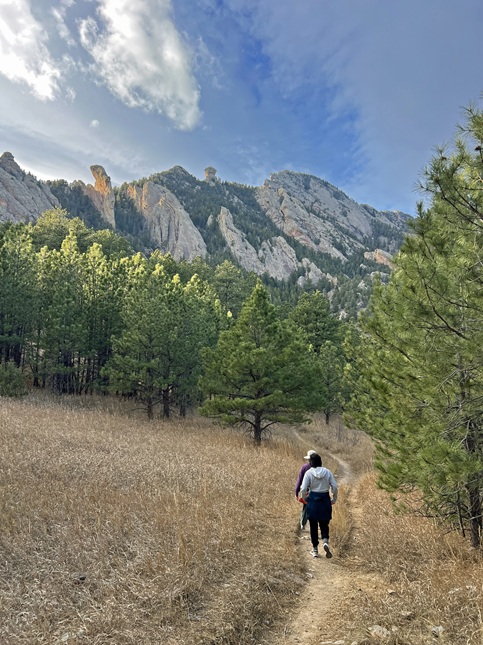
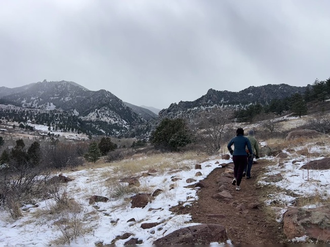
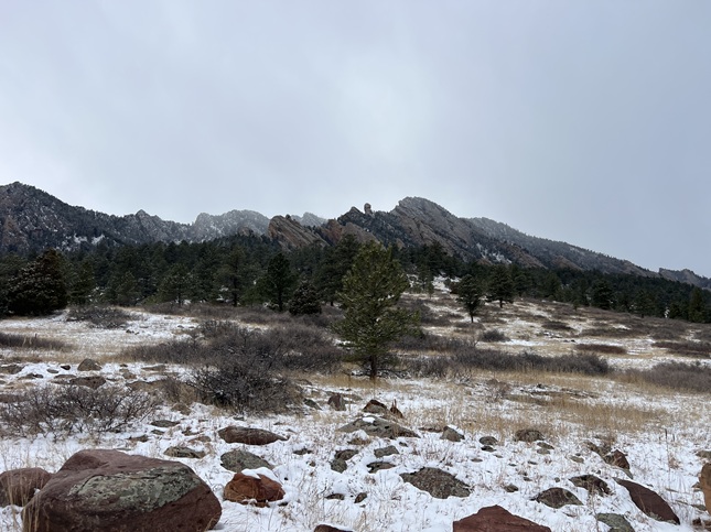
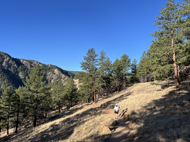
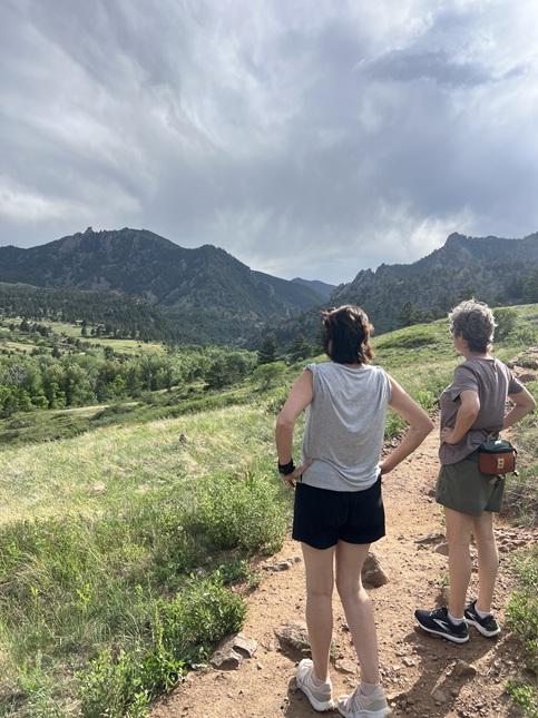
23) Anemone Point and Mt. Sanitas, Boulder City Open Space & Mountain Parks, Boulder, CO, March 25, 2026 - This was two hikes combined into a single morning. It started with Jonna and Alan joining our friend Julia at the Centennial parking lot to hike part of the Anemone Loop trail. We went up the Anemone Trail to the loop, then took the shorter route up to first Realization Point and then on up to Anemone Point. Rather than completing the loop once we got to the top we turned around and headed back down the way we'd gone up. We started hiking at 7:30am so we had both cool morning weather with temps in the mid-60s and low morning sun. When we got back down to the parking lot Julia had to get to work and Jonna had errands to run so Alan head out on his own to hike a new-to-him loop of trails. First was the Sunshine Canyon trail which just follows Sunshine Canyon road for a mile or so going west up the canyon. That trail ended at the Lion's Lair trailhead which starts the climb up the western side of Mt. Sanitas. This trail is just a long series of switchbacks which ended up spreading the roughly 1,000 feet of gain over about 3.5 miles of trail. The Lion's Lair trail eventually connects with the Mt. Sanitas trail just below the summit. By the time Alan got to the top of the mountain the temperature was climbing so it felt like a full blown summer hike with bright sunshine and warm air. Then it was down the Mt. Sanitas trail to get back to the Centennial parking lot where Jonna returned to pick up Alan. A nice, long hike and chance for Alan to hike two new trails! A 8.3 mile loop with 2,000 feet of elevation gain.
24) Green Mountain, Boulder County Open Space & Mountain Parks, Boulder, CO, March 29, 2026 - Another Sunday evening hike with our friend Desiree but we decided to try a different trail. I can't believe I'm saying this in March but we headed up into the front range mountains to find some cool air since the temperature was up into the 80s in Boulder. We drove up to the top of Flagstaff Mountain and then headed over to Green Mountain. However, we were all feeling pretty tired (Alan had spent the day felling and bucking trees!) and ended up running out of steam before making it to the top of Green. Despite turning around early we got to enjoy some nice views looking north along the Front Range with the long shadows being cast across Boulder from the setting sun in the west. A 3.3 mile up and back hike with 850 feet of elevation gain.
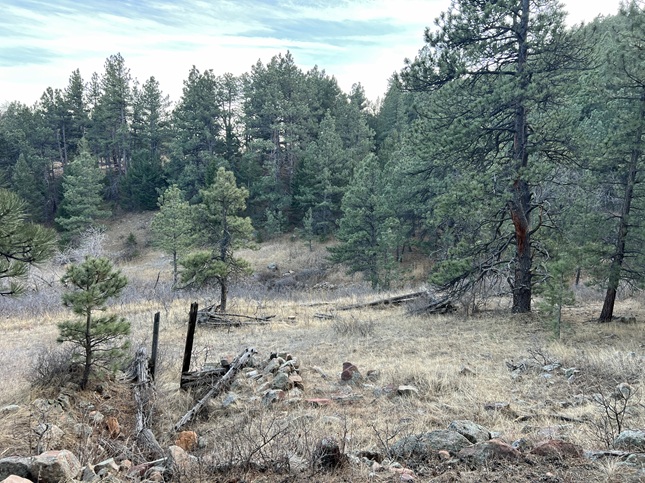
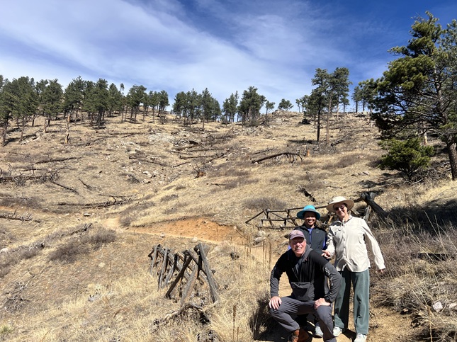
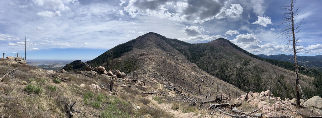
25) Vasco Mine #10 and Ridge Road Trails, Nederland, CO, March 31, 2026 - We have been talking with our friend and neighbor(-ish) Kipp for about a month about getting together one evening to hike one of our local unofficial trails. Finally, on a Tuesday evening, Kipp and Alan made it happen. Alan hiked from home along the Vasco Mine #10 trail towards where Kipp lives. Kipp and his dog Choogie met up with Alan on the trail and we continued going east along the trail. However, we weren't alone. Our warm, dry winter has resulted in an explosion of ticks in our area and we were encountering them as we hiked. We were stopping about every 50 feet to flick ticks off our pants and stopping every quarter mile to dig through Choogie's fur to pull ticks off the pup. We could see ticks lined up on the dry stalks of grass alongside the trail - sometimes two or three ticks to a blade of grass. It was shocking! Fortunately, once we got to the end of the Vasco Mine #10 trail we crossed Ridge Road and moved onto the Ridge Road trail system which is a mix of 4x4 roads and wide single track trails. It also goes through the burn area so more open with fewer trees, less underbrush and less grass. We still picked up a few ticks hiking through this area but we weren't having to stop every 20 steps to deal with them. The sun set while we were hiking and the temperature cooled down but we managed to complete most of the loop we'd planned so it was a successful get together! A 3.5 mile loop with 475 feet of elevation gain.

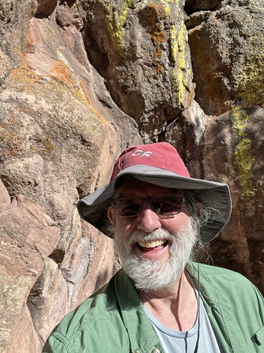
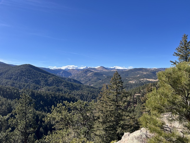
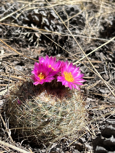
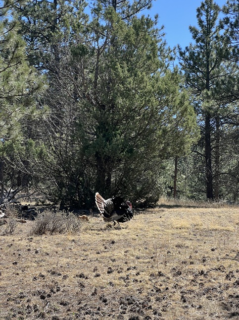
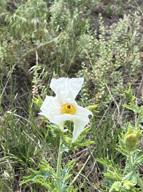
26) Old Sleepy Lion, Sleepy Lion, Button Rock and Nighthawk Trails, Button Rock Preserve and Hall Ranch Open Space, Lyons, CO, April 4, 2026 - Friend Todd and Janeth came up with the idea of a long hike from the Longmont Reservoir Dam to Hall Ranch Open Space by stringing together four different trails. I was up for the challenge so met up with them at Hall Ranch on a chilly Saturday morning where we left a car and then drove over to the Longmont Reservoir just outside Lyons. From there we started by hiking up the Old Sleepy Lion trail which is a little used trail in the Button Rock Preserve that climbs up a steep hillside that gives a nice view down into the North Saint Vrain Creek valley. We then met up with the Sleepy Lion trail and used that to climb further up until we met up with the Button Rock Trail. This trail provided the most impressive scenery of the hike with great views of Mt. Meeker and Long's Peak to the northwest. We also spotted a couple of herds of deer, some wild turkeys, flowering barrel cactus and even a hillside sparkling with mica. Button Rock Trail broght us into Hall Ranch Open Space where we connected with the top of the Nighthawk Trail. We used that trail to drop down the 1,500 feet from the highest point of the hike down to the Hall Ranch trailhead where we'd met up in the morning. The weather was great, warming up just enough to make for a comfortable hiking temperature and with only a slight breeze to cool things down at the times we needed motivation to keep us moving. The skies were clear and we had enough sun that we all had pink cheeks when we finished the hike. A 9.3 mile one-way hike with 1,300 feet of elevation gain.
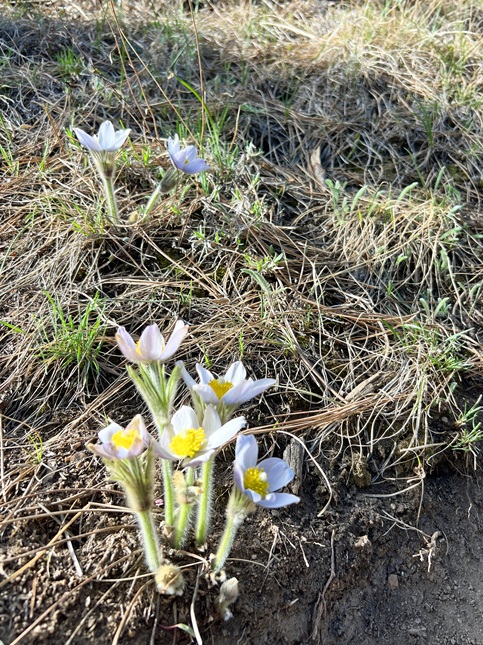
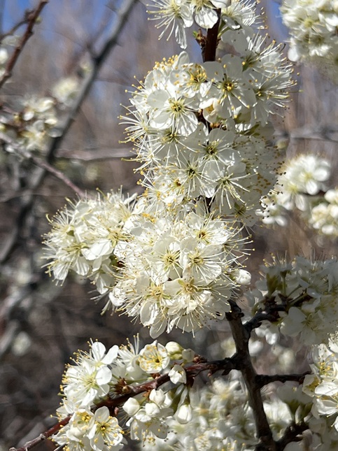
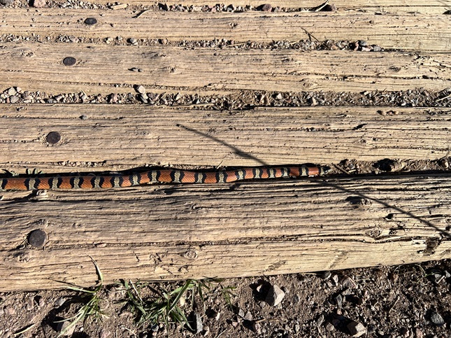
27) Homestead, Mesa, Upper Big Bluestem and Big Bluestem West Trails, South Mesa Trailhead, Boulder Open Space & Mountain Parks, Boulder, CO, April 5, 2026 - This was another Sunday so time for our mostly weekly evening hike with our friend Desiree. With travels on the near horizon for all of us this was probably our last hike together for a couple of months so we did what has becomes our "new normal" loop encompassing Homestead, Mesa, Upper Big Bluestem and Big Bluestem West trails. We started in the late afternoon but with the sun setting later and later now we still had plenty of light for our hike. Most of the spring wildflowers aren't showing their buds yet but there were a few pasque flowers and trail daisies that were open. Most prolific were the flowering mountain ash trees which were loaded with flowers. The highlight of the hike though was coming across a kingsnake out sunning on the trail, the first one I've seen in Colorado. A 4.8 mile loop with 800 feet of elevation gain.
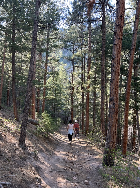
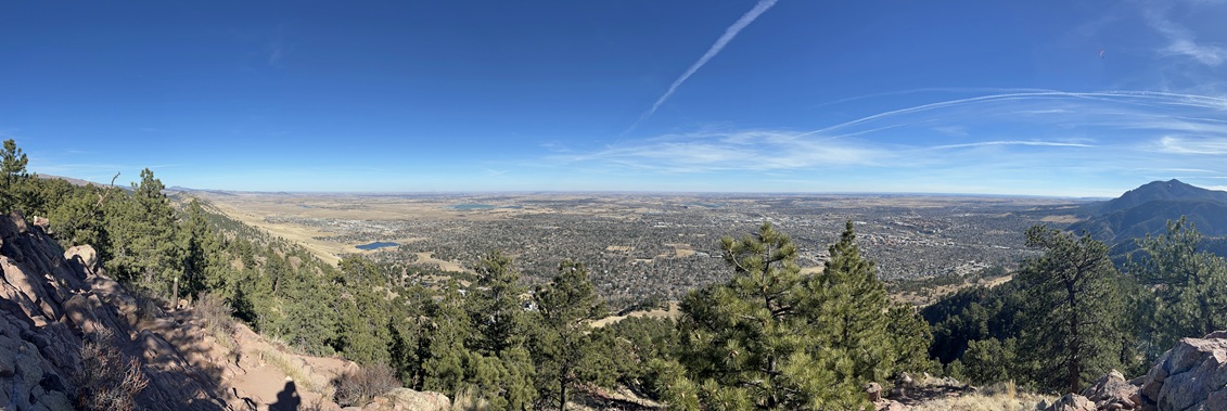
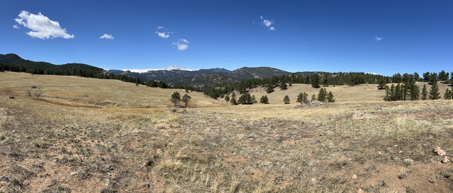
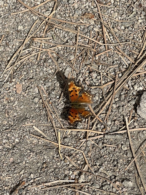
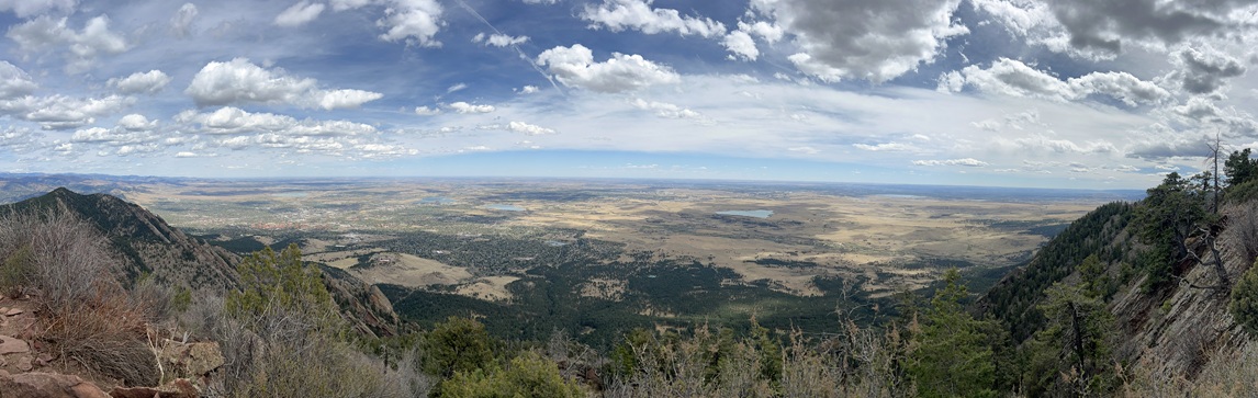
28) Bear Peak, Boulder Open Space & Mountain Parks, Boulder, CO, April 12, 2026 - It has been two years since I've completed the fourth of my annual Spring Training hikes, the climb up Bear Peak, so this year I wanted to be more disiplined about getting the hikes done. So I found myself getting up early on a Sunday morning to drive down to NCAR in Boulder to solo hike Bear. It was cloudy in the morning and just cool enough to be comfortable when burning a lot of calories. My route is the same as has become my norm for this hike: Starting on NCAR Trail all the way west to where it connects with Mesa Trail. South on Mesa Trail down to Bear Canyon Creek then climbing up onto the side of the south side of the canyon. From there I turned onto Bear Canyon Trail which follows the long, curving canyon as it heads northwest towards Green Mountain. Then turning west onto Bear Peak West Ridge Trail for the hike back south (and up!) to climb to the summit of Bear Peak. From the top it is a super steep descent down the Fern Canyon Trail to where it meets Mesa Trail. Then it is just a matter of retracing my footsteps on Mesa Trail back to NCAR trail and the return to the NCAR parking lot. It was a slow climb going up Bear Canyon and as the day moved towards noon the clouds started to thin making for a mostly blue sky with big, puffy white clouds overhead. As the clouds cleared the temperature started to climb so I shed my second shirt layer but fortunately was wearing a long sleeve hiking shirt which kept my arms from getting sunburnt. The climb to the top was a slog so it felt like quite the accomplishment to once again stand on top. Sadly, I didn't have the experience to myself as a ton of trail runners were on all the trails and packed up on top. It was tough to find a rock to sit on while taking in the views on top so I didn't hang around there long. The drop down Fern Canyon was, as always, a knee crusher but fortunately my knees did better on this descent than the past few times I did this hike so that made me feel good about all the hiking I've been doing this Winter & Spring. The highlight of this hike is always the 360 degree panoramic view at the time but second to that were seeing all the butterflies out on the Bear Canyon and West Ridge trails. A beautiful hike, a good workout and a rewarding accomplishment of getting back into my Spring Training Hike routine. A long 9 mile loop with 2,700 feet of elevation gain.
29) Lower McClintock, Enchanted Mesa, Mesa, Bluebell Road Trails, Chautauqua trailhead, City of Boulder Open Space and Mountain Parks, Boulder, CO, May 31, 2026 - Despite having just gotten back from our big 6 week trip to the Balkans and dealing with jet lag from all the travel when invited to join our friend Desiree and her family for a short hike we rallied. Desiree, her parents Juan and Diane, her son Gaelin and Gaelin's friend Tristan were all meeting at Chautauqua Park in Boulder for little stroll so we met up with them at 1:30pm and joined in. We reversed and shortened one of our regular loops to accomodate the older hikers in the group. We had a beautiful day for hiking with some big puffy clouds in a perfect blue sky but very little wind and enough sun to hold the temperature in the 70s. We went up Lower McClintock trail to where it crosses the Enchanted Mesa trail. Then took Enchanted Mesa all the way to where it meets Mesa trail. We then turned north on Mesa trail and took it to where it branches off the Bluebell Road Trail. Finally, Bluebell Road took us back to our starting point at the Chautauqua Park parking lot. A mellow stroll that gave us plenty of time to chat. A short 2.5 mile loop with 475 feet of elevation gain.
30) Homestead and Mesa Trails, South Mesa Trailhead, Boulder Open Space & Mountain Parks, Boulder, CO, June 7, 2026 - Jonna and Alan had a busy Sunday but still managed to squeeze in a short hike with our friend Desiree Sunday evening. We met up at our usual trailhead, South Mesa Trailhead, with some dark clouds overhead and with the kind of sudden strong wind that signals rain. However, the clouds passed by and the wind died back down and we ended up with nice weather for a hike. We did our "short" loop going up Homestead Trail and then back to the trailhead on Mesa Trail so this was as much about socializing as hiking but nonetheless we did get a little exercise so we'll count it. A 3 mile loop with 500 feet of elevation gain.
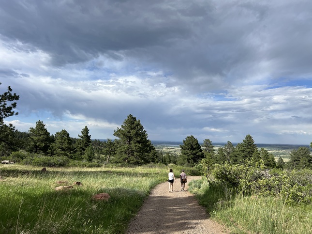
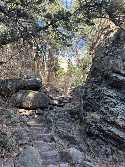
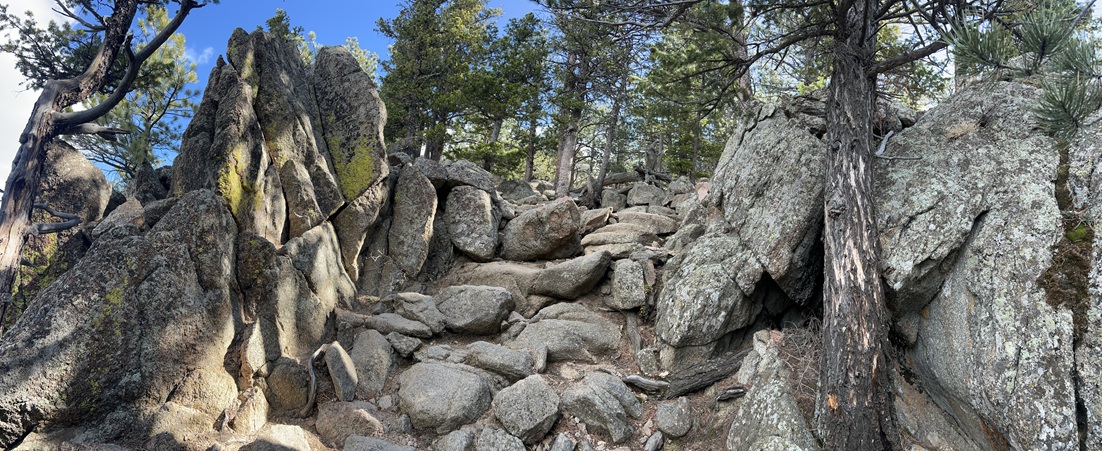
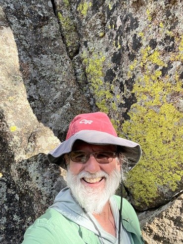
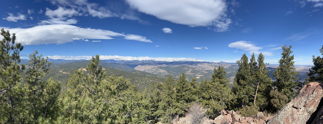
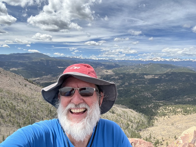
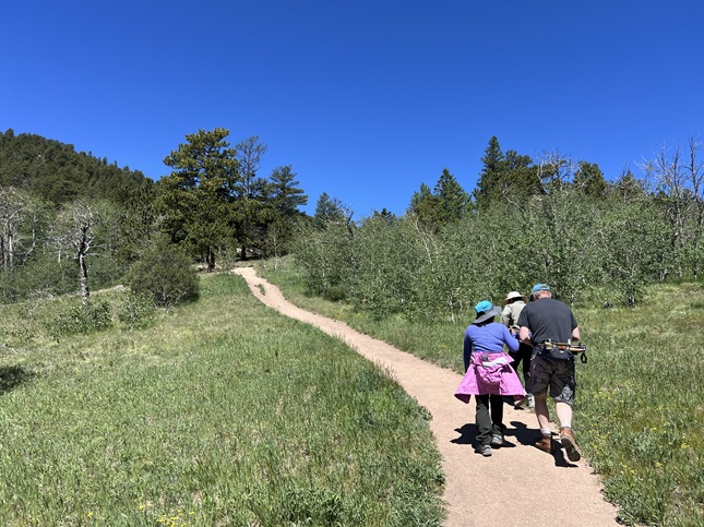
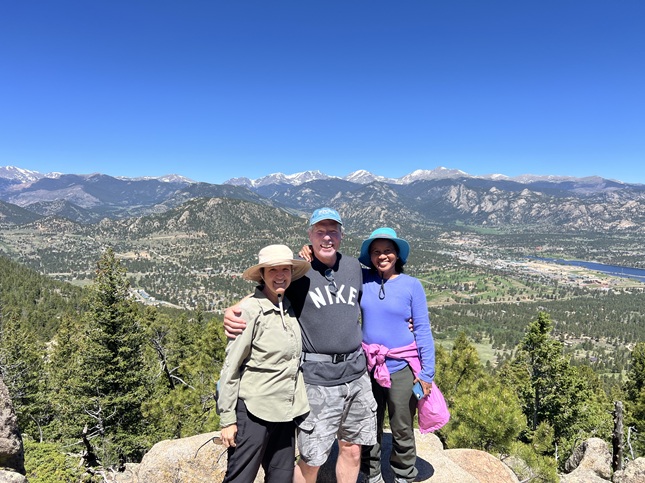
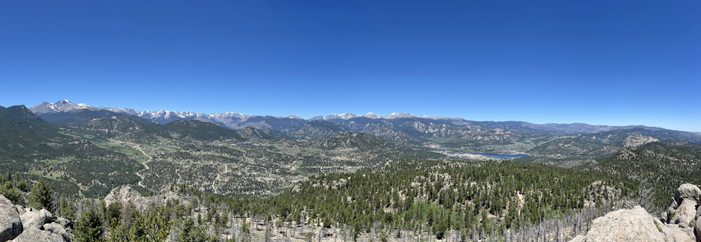
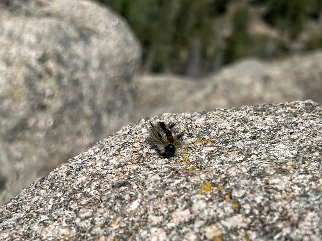
31) Kruger Rock, Hermit Park Open Space, Larimer County, Estes Park, CO, June 11, 2026 - With us back from our Europe trip and our friends Todd and Janeth back from their own trip to the Philippines it was time for us to get together to exchange travel stories. Jonna and I drove to their house in Pinewood Springs and then we all carpooled into Hermit Park Open Space. It was a little cool in the morning but with blue sky overhead it promised to be perfect hiking weather. We did the hike up to Kruger Rock - not a long hike but a steady climb from the trailhead all the way to the summit. The views from the top were fantastic with a 360 degree panorama that included Longs Peak, Estes Park, the lower parts of Rocky Mountain National Park and the back of the front range peaks from Loveland down to Lyons. The weather was, as predicted, perfect so we lounged around on top for awhile taking in the view. We were joined by a cute and fuzzy caterpillar who took turns crawling to each of us. A nice hike and a great chance for us all to catch back up with each other's travels. A 3.6 mile up-and-back hike with 1,000 feet of elevation gain.
If you enjoyed these you may also enjoy checking out some photos from our 2025 hikes.
